The highest continuous highway in the United States, Trail Ridge Road, reaches a maximum elevation of 12,183 feet.
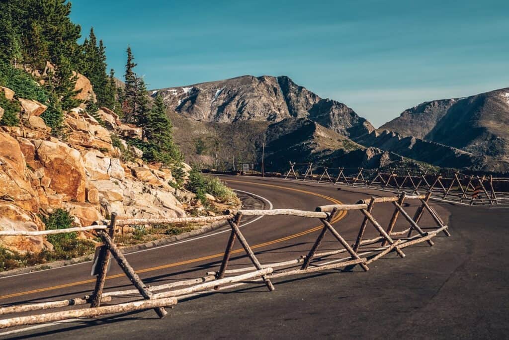
Driving Trail Ridge Road in Colorado
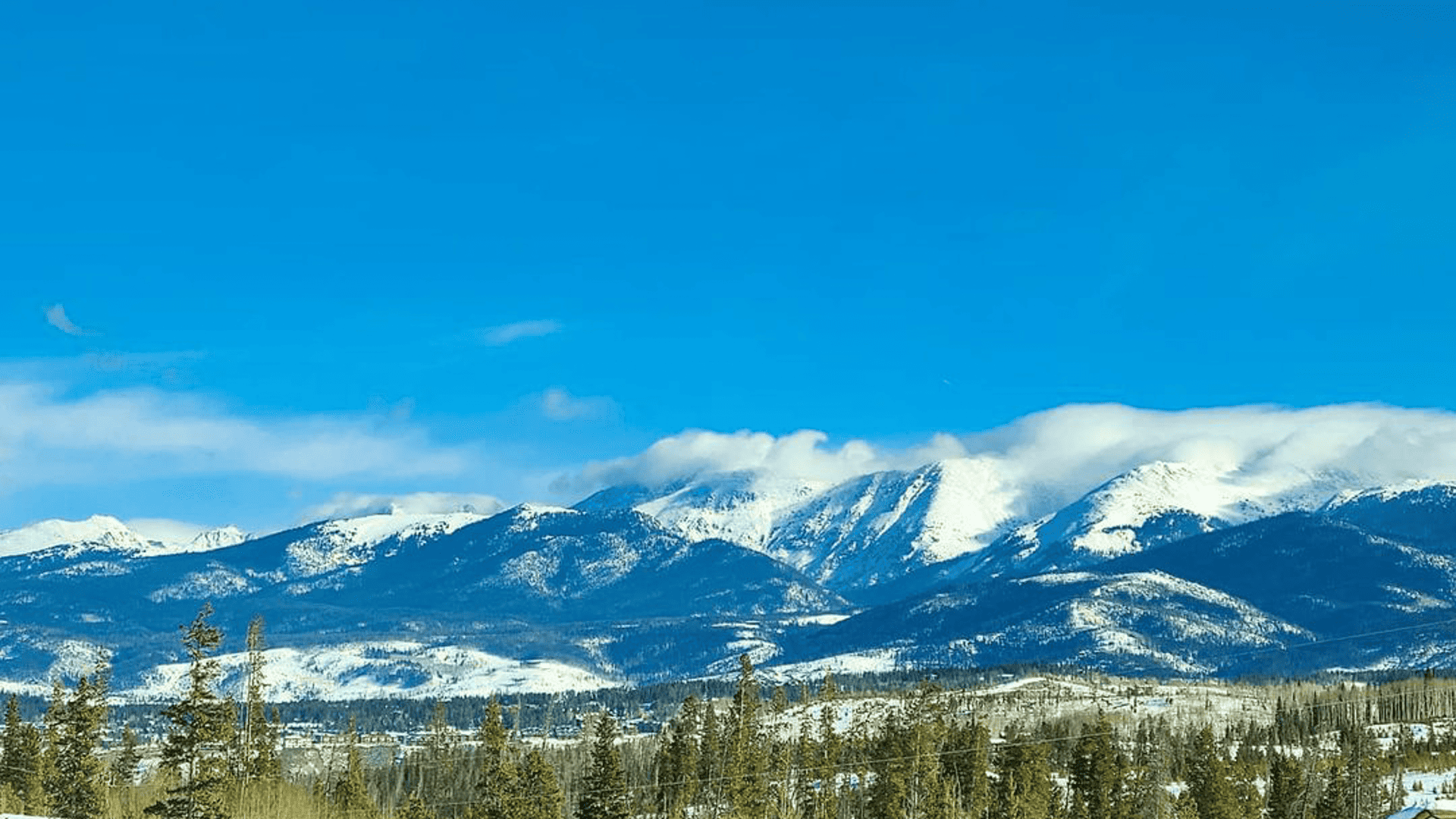
Along all 48 miles that Trail Ridge Road stretches, you’ll have spectacular views of Rocky Mountain National Park. Whether you embark on your scenic drive from Grand Lake or Estes Park, there are some must-see stops you should take along the way.
Rocky Mountain National Park requires a timed-entry permit from late May to mid-October. Make your reservation at Recreation.gov. Get the most up-to-date information on trails and stops on the National Park website.
Know before you go: Trail Ridge Road is open seasonally, typically from late spring to early autumn. Check current Rocky Mountain National Park road statuses to see if it is drivable.
Visitor Centers
Throughout Rocky Mountain National Park, there are several visitor centers that offer educational resources and trip ideas. At the western entrance of the park, you can ask rangers questions at the Kawuneeche Visitor Center and check out topographical maps, hands-on exhibits, educational films and more. Then, make your way to other centers along Trail Ridge Road like the Alpine Visitor Center, all the way to the Fall River Visitor Center on the eastern edge. Stop at one or more and snag a T-shirt and National Park stamp while you’re driving through.
Farview Curve
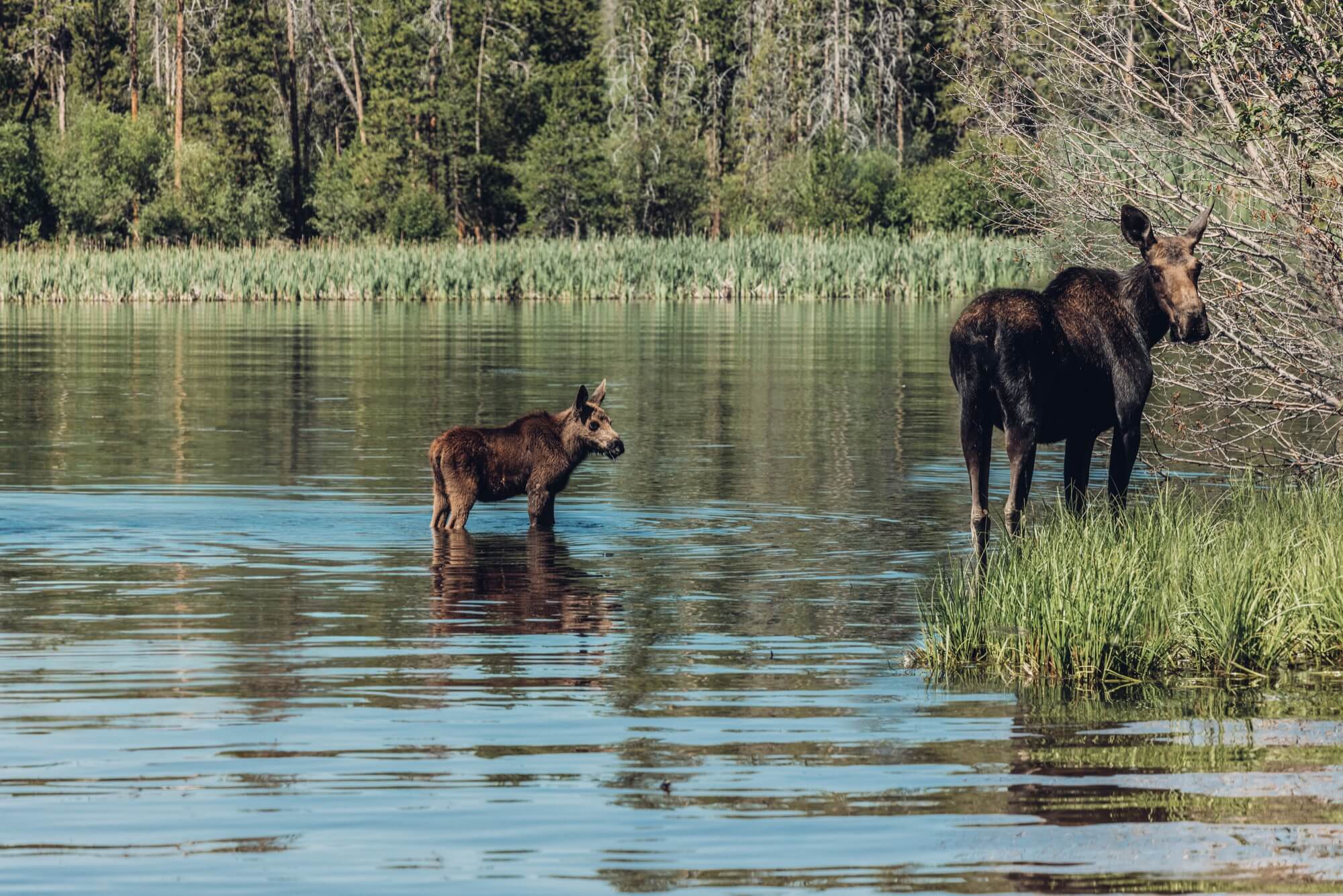
On the park’s western side, just inside the Grand Lake entrance, be sure to stop at Farview Curve Overlook, where you’ll see the Kawuneeche Valley, a favorite marshy hangout spot for elk. In early autumn, when it’s elk bugling season, you’ll spot large packs of bulls and cows (and probably a moose or two!) surrounded by golden aspen trees and pines. With beautiful views of the Never Summer Mountain Range, you’ll want to stop to stay a while.
Milner Pass/Poudre Lake
At 10,759 feet in elevation, Milner Pass has soaring outlooks of the craggy Rocky Mountains. The most notable view you’ll have is of the Continental Divide. Not only does the Continental Divide mark where the Atlantic and Pacific plates converge, but it also divides the headwaters of the Cache la Poudre River to the east from the headwaters of the Colorado River to the west. It is truly a natural sight to behold.
Medicine Bow Curve Overlook
Located at 11,660 feet in elevation, Medicine Bow Curve is a hairpin turn on Trail Ridge Road that descends from the Alpine Visitor Center. A great place to stop for a picnic, the Medicine Bow Curve Overlook has panoramic views of the Medicine Bow and Never Summer mountain ranges — the latter named for its snowcapped summits that last well into summer.
Rainbow Curve
Rainbow Curve reveals a sweeping view of Horseshoe Park, a valley shaped by a 1982 dam break. As you gaze across, you’ll see jagged mountain peaks, the highest of which is Mount Chapin at 12,454 feet. Below, the valley buzzes with life — beavers build lodges, and greenback trout glide through rushing streams amid the rocky terrain and alpine greenery.
Deer Ridge Junction
Located on the eastern side of Trail Ridge Road, Deer Ridge Junction is a perfect place to park and stretch your legs. Take the Deer Ridge Junction trailhead to walk through spruce-lined pathways to towering peaks and green meadows. Don’t forget your camera — this spot is holiday-card worthy!
Many Parks Curve
When you make the stop at Many Parks Curve, you’ll see many majestic mountains, including Longs Peak, the park’s only fourteener (a peak that rises above 14,000 feet). What you might not know right off the bat is that much of this outlook’s scenery was created by glacial ice thousands of years ago.
Ute Trail
The Ute Trail turnout offers history and beautiful views of nearby mountains. Ute Trail used to be a pass for Ute and Arapahoe Indians to travel between their summer and winter hunting grounds. Later, the route became more established by the frontier settlers, and it is now part of Trail Ridge Road, bringing visitors past bright green grasses and sparkling lakes.
Rock Cut
A rugged rock formation rising to 12,110 feet in elevation, Rock Cut was not easy to get around for early travelers. In fact, crews completing the Trail Ridge Road we know today had to cut through the rock to continue building. Stop at the turnout near Rock Cut, then hike over to an overlook on the west side of the road for a stunning picture.
Gore Range
The Gore Range Overlook provides a new perspective on the beautiful Never Summer Mountains and, of course, Gore Range. Located at 12,048 feet in elevation, this spot brings you above treeline to alpine landscapes — be sure to bring plenty of water to prepare for the high altitude.
Alpine Ridge Trail
Alpine Ridge Trail is a short, 1/4-mile hike to a rocky outlook. However, since the trailhead is located at 11,796 feet in elevation, and the trail goes up about 300 feet in elevation from there, the hike is pretty strenuous for the average visitor. Take it slow and take breaks as needed. The wildflower-filled path — often peppered with elk and other wildlife in the distance — is worth the huffing and puffing.
Make sure to always check road conditions before heading out on Trail Ridge Road. Learn more about Trail Ridge Road and get the most up-to-date information on the National Park website. Don’t forget to Stand Grand and Leave No Trace while exploring.
Uncover More Grand County Adventures
- Take a bite out of these restaurants in Grand Lake.
- Get a beginner’s guide to Rocky Mountain National Park.
- Find the coolest places to stay when visiting Rocky Mountain National Park.
- Cruise along our favorite scenic byways and drives in Grand County.
- Check out even more Rocky Mountain summer trip ideas.