Byers Peak Wilderness
Difficulty: All Levels
Length: 23 Miles of Trails, various hikes and lengths
Access Points: There is an East and West access point:
East Access
East Access (the easiest from the Winter Park/Fraser Valley): From US Highway 40, drive North toward Fraser. Turn left at the traffic light in the center of town (adjacent to Safeway), onto County Rd. 72. and drive for .2 miles. Turn right onto the Fraser Parkway for .8 miles, and then turn left onto County Rd. 73 and drive for about 7 miles as it turns into Forest Road 160.2. Follow this to trailhead - pass the 1st 'Y' in the road, and at the second 'Y', make a sharp right onto Forest Rd 111. You'll see a Byers Peak Trailhead sign - follow that road until you get to the gate.
West Access
West Access (near Parshall): From Winter Park, drive Northwest on US Highway 40 and continue on toward Granby and then into Hot Sulphur Springs. Keep driving through Hot Sulphur Springs and through Byers Canyon. Between mile post 197 and 198, turn south onto County Rd. 3 and watch for mile marker 15. Right after mile marker 15, you'll see County Rd. 32. Take County Rd. 32 for 4.7 miles and then turn right onto FR-136 (marked for Lake Evelyn and Bottle Pass Trail). Drive another 4 miles until you reach the trailhead parking lot.
Byers Peak Wilderness Info
Established in 1993, Byers Peak Wilderness Area encompasses 8,801 acres within the Arapaho and Roosevelt National Forest in Grand County. Byers Peak Wilderness is home to a variety of different eco-zones due to drastic elevation changes within the area, which allow an assortment of flora, fauna and wildlife to live within the Byers Peak Wilderness boundaries.
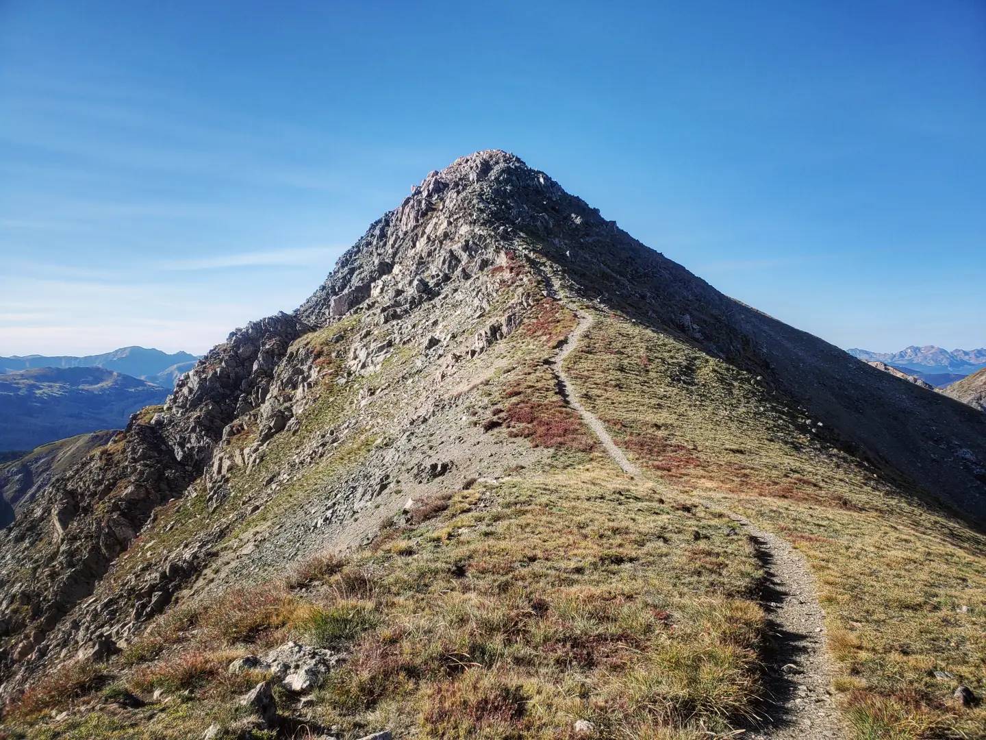
There are two glacial lakes, three major creek drainages and two peaks over 12,500 feet within Byers Peak Wildness. Byers Peak reaches the highest elevations with a summit of 12,804 feet accessible via the Byers Peak Trail. Byers Peak Wilderness contains 23 miles of trails offering panoramic views and some of the finest ridge hiking in the state. Views worth the effort are available from atop the peak itself, accessible via the Byers Peak Trail, a distance of 8.6 miles round-trip from the trailhead.
While hiking and sightseeing are the primary attractions, you can fish or fly fish in Lake Evelyn, St. Louis Lake and West St. Louis Creek. The only designated campground within the wilderness area, the Byers Peak Campground, has been closed indefinitely due to the beetle kill infestation, but camping most anywhere in the Byers Peak Wilderness is permitted; you must camp at least 100 ft. from a water source or a trail, and any human waste must be buried in a hole that's at least 8 - 10 inches deep, or double bagged and carried out. Everything that is packed in with you must be packed out.
Mule deer, elk, ptarmigan, and marmots are common sights, but the biggest lure is the peace and quiet that Byers Peak Wilderness provides to its visitors. Always use “Leave No Trace” techniques to help keep this area wild, clean, and pristine.
Fishing in Byers Peak Wilderness requires a Colorado Parks and Wildlife Pass and a fishing license.
For more information regarding camping restrictions, current road and trail conditions, contact the Sulphur Ranger District at 970-887-4100.
Explore Just Outside of Town
Explore miles of high-elevation trails with rewarding hikes and sweeping views.
Getting Around
Once you get to Grand County, use one of our local transportation options to navigate from town to town.
Maps & Guides
Find your way around Grand County towns.
Request Info
Sign up to receive our monthly newsletter. Learn about updates, trip planning ideas, specials and events in Grand County, Colorado.
Start Planning
Find your dream hotel, camping spot or lodge and start planning outdoor excursions, dining and must-see stops for your Grand County itinerary.